I have to say this was as hard as or harder than some of the higher peaks I had climbed that year - 2005, perhaps because I was mentally geared towards a gentle, smooth easy trail to the top. I guess there really is no such thing as an easy peak in Wyoming. The only thing easy about this one was the drive there. The trail head is 200 ft from a paved road.
I still would like to find the lunatic, who's sick mind took pleasure in giving this peak such a name.
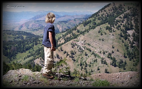
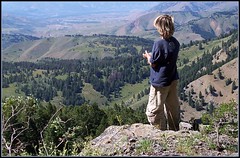
This peak has exceptional views from the top. The Tetons, Wind River, Gros Ventre, Wyoming and Snake River ranges are visible on clear days. The most used starting point for Cream Puff starts at the Poison Creek Trail head. From Jackson, WY drive 13 miles south on 189 to the Hoback Junction, stay left and drive (still on 189) 4.8 miles and turn left onto a small gravel road that terminates in a parking lot after a couple of hundred feet.
The Poison Creek approach is closed to the public from December 1 to April 30. It is to protect the Bighorn Sheep that winter here every year. These Bighorns can sometimes be seen from the main paved road. This area, including Cream Puff, is located in the Gros Ventre Wilderness area and is subject to all the rules normally associated as such.

There are several camping areas, both public and private, nearby. Some restrictions apply due to the popularity of the Snake River Canyon area.
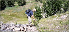
There is a trail that goes up the small drainage, do not take it. Instead hike to the right (east) to top of the grassy ridge. A trail appears near the top and continues up the ridge for 1/2 mile where it enters the trees. It becomes very steep, few switchbacks, and winds along a sometimes shaded, sometimes sunny ridge. The trees thin towards the top and gets a little cliffy in places. Be careful as you make your way around the last of the cliffs on your left and then a short hike to the summit.
This trail is +- 2.5 miles long and gains 3430 feet. A solid class 3 scramble.
Trent and I had a blast though we could have used a bit more water!
Note: There is NO water on the route, bring more than you think you need......
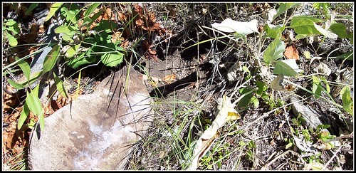
We observed sign of bear(s) in the area on the way up. Many, many rocks overturned and some tracks. There looked to be some sort of cricket (that gradually develop the adult body shape by changing each time they molt, or shed their exoskeleton) that the bears were feeding on. Hundreds and hundreds of these molted exoskeletons littered the side of the lower slopes of this mountain. These bugs, when present, must have been like candy for the bears. Take standard precautions.......
I have to say this was as hard as or harder than some of the higher peaks I had climbed that year - 2005, perhaps because I was mentally geared towards a gentle, smooth easy trail to the top. I guess there really is no such thing as an easy peak in Wyoming. The only thing easy about this one was the drive there. The trail head is 200 ft from a paved road.
ReplyDeletered and black salwar kameez designs ,
red black suit salwar ,